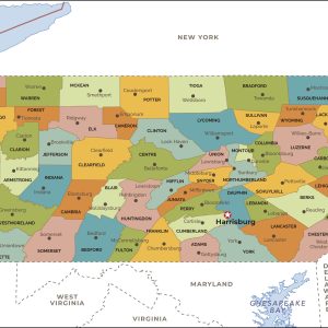
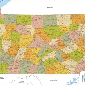
This map has been created and designed for reference or business use. Clear and clean colors & fonts matched with cartographic research makes this map of Pennsylvania Counties Map easily readable and useful. The map shows the 67 counties of Pennsylvania and their borders across the Keystone State. This map is rolled and shipped in…
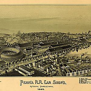
Pennsylvania R.R. Car shops in Altoona, PA by T. M. Fowler, 1895This beautiful antique map reproduction is printed on heavy acid-free stock with fade proof inks and is excellent for framing. 30 W x 16 H
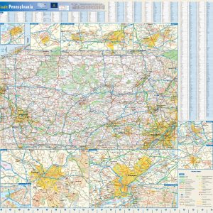
This colorful, easy-to-read state map of Pennsylvania identifies all major thoroughfares, secondary roads, freeway interchanges, rest areas, distance markers, landmarks, recreational areas, and more. Shaded relief on the state map provides a three-dimensional sense of Pennsylvania s topography. Detailed city inset maps of Allentown, Erie, Harrisburg, Lancaster, Philadelphia, Pittsburgh, Scranton Wilkes-Barre, and State College are…
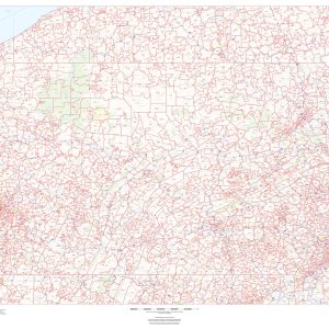
This map of Pennsylvania shows ZIP codes overlaid on a road map. Base map features include municipality and county boundaries, major road network features, and state and national parks and conservation areas. This map is rolled and shipped in a sturdy cardboard tube.
This map has been created and designed for business or reference use. Clear and clean colors & fonts matched with cartographic research makes this Pennsylvania Zip Code Map with Counties easily readable and useful. The map shows the 67 counties of Pennsylvania and the borders of the over 1,700 zip codes across the Keystone State….
Rand McNally s regional wall map of Philadelphia is ideal for anyone needing a comprehensive representation of the area for planning, routing, or reference. It s a great choice for business and sales strategy, urban development, social work outreach, education, and marketing. Philly residents, businesses, and government offices are sure to find this wonderful reference…
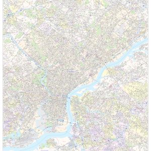
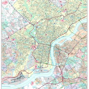
This map of Philadelphia County, Pennsylvania shows street level information including street labeling. Base map features include all roads with major roads and highways labelled; neighborhood names; railways; high level land use such as parks and recreation areas, industrial areas and hospital campuses; and a variety of points of interest including libraries, stadiums, museums, border…
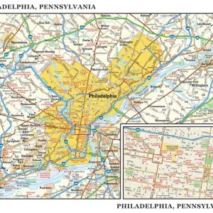
This detailed reference map combines two maps in one – a map of the greater Philadelphia area plus a street-level map of historic, downtown Philadelphia. The metropolitan map shows the area s cities and towns, highways and roads, and a variety of points of interest. The map includes the surrounding suburban cities in Pennsylvania and…
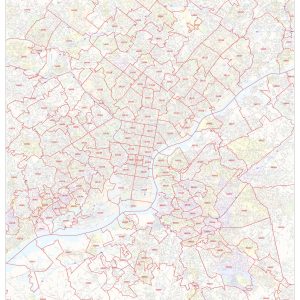
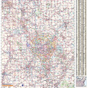
This map of Philadelphia shows ZIP code areas overlaid on a road map. Ideal for planning of deliveries, home services, sales territories, real estate and much more. Base map features include all roads with major roads and highways labelled; neighborhood names; railways; and high level land use such as parks and recreation areas, industrial areas…
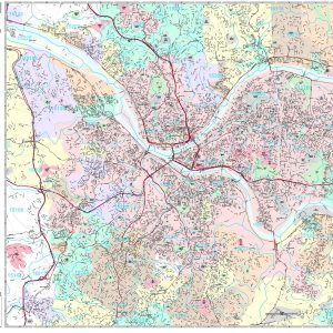
Rand McNally s regional wall map of Pittsburgh is ideal for anyone needing a comprehensive representation of the area for planning, routing, or reference. It s a great choice for business and sales strategy, urban development, social work outreach, education, and marketing. Pittsburgh residents, businesses, and government offices are sure to find this wonderful reference…
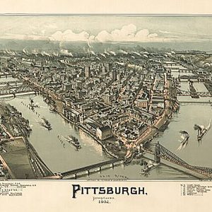
Pittsburgh, Pennsylvania by T. M. Fowler, 1902This beautiful antique map reproduction is printed on heavy acid-free stock with fade proof inks and is excellent for framing. 24 W x 16 H
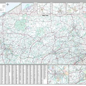
Save money on our full line of wall maps from one of the industry leaders in wall maps. These always up to date, eye catching wall maps come in a variety of sizes and finishing options sure to meet your specific mapping needs. Features include: Interstate Us State Highways 5-Digit ZIP Codes County Names and…
Save money on our full line of wall maps from one of the industry leaders in wall maps. These always up to date, eye catching wall maps come in a variety of sizes and finishing options sure to meet your specific mapping needs. Features include: Interstate Us State Highways 5-Digit ZIP Codes County Names and…
Save money on our full line of wall maps from one of the industry leaders in wall maps. These always up to date, eye catching wall maps come in a variety of sizes and finishing options sure to meet your specific mapping needs. Features include: Interstate Us State Highways 5-Digit ZIP Codes County Names and…
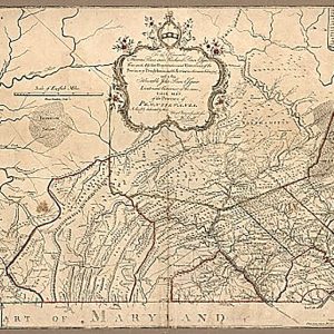
Province of Pennsylvania by William Scull, 1770This beautiful antique map reproduction is printed on heavy acid-free stock with fade proof inks and is excellent for framing. 32 W x 21 H
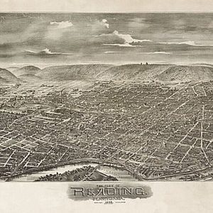
Reading, Pennsylvania by Bailey & Moyer, 1898This beautiful antique map reproduction is printed on heavy acid-free stock with fade proof inks and is excellent for framing. 27 W x 18 H