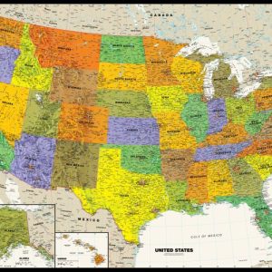
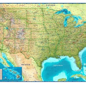
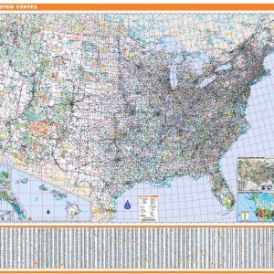
Perfect for home, business, or school, this Contemporary USA Wall Map combines bright, attractive colors with high-detailed cartography. Details on this United States Wall Map include: state boundaries and capitals along with other major cities and towns; major physical features such as mountain ranges and major mountain peaks; major water features such as oceans, seas,…
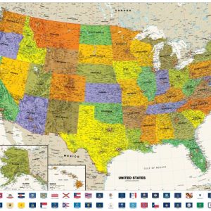
Perfect for home, business, or school, this Contemporary USA Wall Map with Flags combines bright, attractive colors with high-detailed cartography. Details on this United States Wall Map include: state boundaries and capitals along with other major cities and towns; major physical features such as mountain ranges and major mountain peaks; major water features such as…
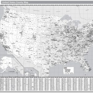
Rand McNally s United States County Wall Map shows county outlines and major cities, making it ideal for use as a business analysis tool. The black and white map is laminated and comes with hanging rails for easy display options. Full black and white representations of all states Outlines of all U.S. counties and indications…
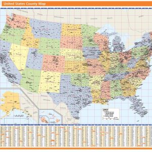
Rand McNally s United States County Wall Map shows county outlines and major cities, making it ideal for use as a business analysis tool. The full-color map is laminated and comes with hanging rails for easy display options. Full color representations of all states Outlines of all U.S. counties and indications of major cities 48…
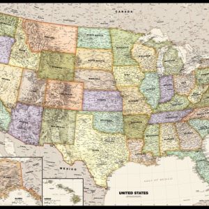
The Compart Maps USA Wall Map is beautifully illustrated with vibrant greens, browns and blues. The detail is highly legible with state borders clearly defined. In classic Antique Atlas style, this map can be used for general reference, to track current events, or as a piece of art. Perfect for an office, classroom or decorating…
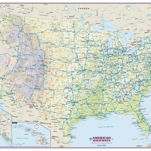
Perfect for home, business, or school, this US Interstate Highways wall map shows the Interstate Highway System of the United States, along with other important Federal and state highways. Details included on this wall map consist of: international and state provincial boundaries, freeways, tollways and other major roads; cities and towns; time zones; and all…
Perfect for home, business, or school, this Legacy USA Wall Map combines bright, attractive colors with high-detailed cartography in an antique style. Details on this United States Wall Map include: state boundaries and capitals along with other major cities and towns; major physical features such as mountain ranges and major mountain peaks; major water features…
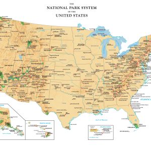
Perfect for home, business, or school, this US National Park Service wall map shows the location of all sites operated by the National Park system in the continental United States, Alaska, Hawaii, Puerto Rico and the U.S. Virgin Islands.
Rand McNally s ProSeries United States Wall Map is an irreplaceable reference tool for anyone needing a comprehensive representation of the country for planning, routing, or reference. The large size and detailed laminated map make it a great addition to any office or board room. Map indications include: Interstates, federal highways, and state highways…
Video presentations on Islamic Conquest Past & Present, Political Islam s 1400 Year War on the West (16 half-hour episodes, MP4, USB Flash Drive) Topics include: In 2006, Keith Ellison became the first Muslim elected to the United States Congress. He swore in on a Qur an. Most Americans know little about the Qur an,…
Adapted from Miracles in American History: Volume TWO: Amazing Faith that Shaped the Nation by Susie Federer, focusing primarily on famous revivals. Dynamic, inspiring & professionally produced episodes, approximately 28 minutes each (Part of an expanded 44 episode series on four DVDs) Episodes 1 – Miracles in American History-Volume Two Overview (DLKM) 2 – The…
40 video episodes (approximately 10 minutes each) based on the book Miracles in American History: Amazing Stories of Answered Prayer, focusing primarily on famous battles (contains contents of all 4 Miracles DVDs)
USB with 5 video episodes and pdf ebook How was the time Saint Patrick lived in similar to today? The Roman Empire was falling: *Illegal immigrants overrunning boarders *Latin Language displaced *Immorality *Exposure of unwanted infants *Violent gladiatorial entertainment *Outsourcing to North Africa *Enormous debt & government *Explosion of welfare & government jobs *Taxes unbearable…
Video messages Socialism-The Real History from Plato to the Present: How the Deep State Capitalizes on Crises to Consolidate Control (5 presentations & interviews, including 700 Club, and Calvary Chapel Chino Hills, 11 1 20, MP4, USB Flash Drive) – – – SOCIALISM: THE DREAM OF AN IDEAL SOCIETY? Is it a wonderful utopia or…
Who is the King in America? USB Flash Drive of 28 lectures and interviews in mp4 file format which can be played on computers and smart TVs. Who is the king in America? Before you answer, do you know what the most common form of government in world history? From the invention of writing around 3,300 BC,…
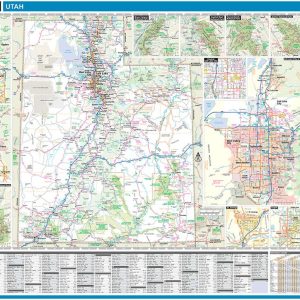
Laminated with Hanging Rails 60 W x 46 H Index of Counties and Cities Fully Indexed Counties, Cities, Mileage Chart Inset Maps of All Major Cities Free Shipping! This map is rolled and shipped in a sturdy cardboard tube.